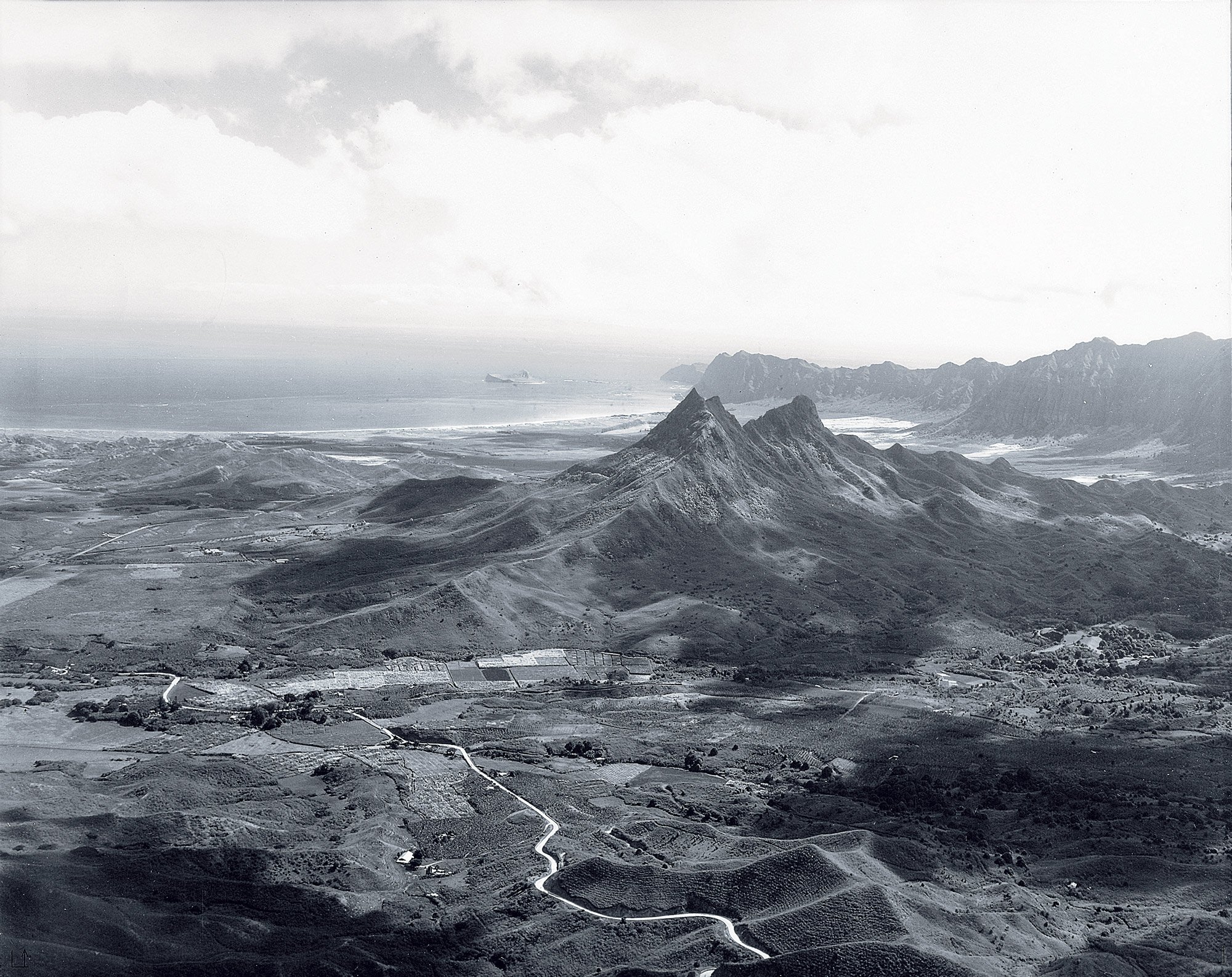
Historic photo of Olomana from the Ko‘olau mountains, showing Maunawili. This view of Maunawili shows Auloa Road in the foreground and abundant small scale agricultural fields at the base of Olomana. (Roscoe C. Wriston, 1936, Lyman Museum, from the book Kailua, published by the Kailua Historical Society, 2009, p. 93.)
To better align property boundaries with the nonprofits’ long-term plans — and for TPL, the state and the community organizations to use the public funds they have raised for the purchase — the boundaries of the land’s six current parcels must be redefined. Therefore, with the input and support of TPL, the state and the community organizations, The Harry and Jeanette Weinberg Foundation is submitting a consolidation and resubdivision application to the city and county Department of Planning and Permitting to realign the boundaries of existing parcels for conservation purposes. This process does not involve any changes to current zoning.

Maunawili Forest & Lo'i proposed consolidation & subdivision, 3D view
KAILUA, KO'OLAUPOKO, O'AHU, HAWAI'I
Click on image for a larger view. View hi-res PDF in a new window ➙ click.
Maunawili Forest & Lo'i proposed consolidation & subdivision, aerial view.
KAILUA, KO'OLAUPOKO, O'AHU, HAWAI'I
Click on image for a larger view. View hi-res PDF in a new window ➙ click.